Conflict doesn't stop at the atmosphere

Most tools that track grey zone and hybrid conflict stop at the edge of the atmosphere. They cover maritime harassment, proxy operations, cyber intrusions, electronic warfare on the ground. Some do it well. But the moment a conflict extends into orbital space, the picture goes dark. Satellite proximity operations, space-based jamming campaigns, co-orbital anti-satellite activity: that data exists in open reporting, in government statements, in academic literature. It just never appears alongside the terrestrial picture.
That disconnect has been bothering me for a while.
I have been writing about megaconstellations, orbital deterrence and the militarisation of low Earth orbit for some time. The research keeps returning to the same observation: modern grey zone competition does not respect the Karman line. A GPS jamming campaign over the Baltic and a Russian inspector satellite parking next to a US intelligence asset in GEO are part of the same strategic logic. They should be on the same map. They almost never are.
There are platforms out there tracking elements of this space, and some do really useful work. But I kept running into the same limitation: the terrestrial and orbital pictures are treated as separate phenomena, sitting in separate tools, never quite connecting. I wanted something that spanned the full spectrum in a single view, that was open, and that actually looked like the problem it was trying to represent. So I started building it myself.
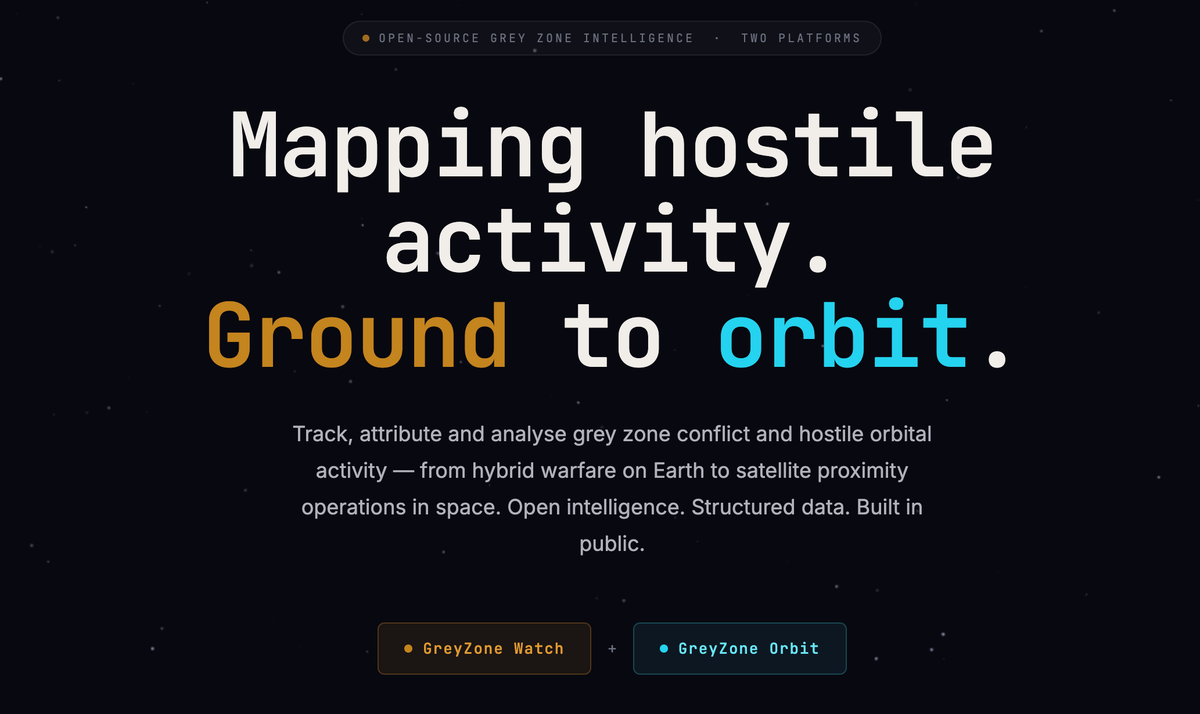
Introducing the greyzone platform
Greyzone is an open-source grey zone intelligence platform, currently in active development, designed to track, attribute and analyse hostile activity from the ground to orbit. It is a single platform with two views: greyzone.watch and greyzone.orbit, both that will be accessible at greyzone.watch and built on a shared architecture and data model. The cross-domain connection that is missing elsewhere is built into the foundation here, not bolted on as an afterthought
greyzone.watch maps grey zone & hybrid warfare incidents geographically. Submarine cable interference, electronic warfare, proxy operations, covert cyber campaigns: incidents plotted on a live map, coded by domain and severity, each one linked to primary source material and carrying an attribution confidence level. The research dashboard sits alongside the map, giving analysts trend lines, domain breakdowns and pattern analysis over time.
greyzone.orbit takes the same logic into space. It's an open-source space security incident tracker built around a 3D orbital globe. Rendezvous and proximity operations, ASAT tests, space-based electronic warfare, dual-use platforms: each incident is structured with actor and target satellite identifiers, NORAD IDs, orbital parameters and full attribution chains. The globe visualises incidents in three dimensions, with LEO, MEO and GEO shell rings and incident arcs showing the geometry of each event.
Both platforms currently carry curated historical demonstration data drawn from real, sourced incidents. The architecture is live. The data model is live. Automated ingestion and live feeds are on the roadmap.
Why open, and why now
The decision to build in public is deliberate. Good open-source reporting on grey zone activity exists. Investigative outlets, think tanks and research centres do serious work across individual domains. What is harder to find is a single structured platform that pulls it together, spans the full spectrum from terrestrial to orbital, and makes the aggregated picture accessible to analysts and researchers without a subscription or an institutional login. That is what Greyzone is trying to be.
The cross-domain architecture is what makes it different. If you want to understand how state actors operate in the grey zone, you need the full picture. Terrestrial operations and orbital operations are not separate phenomena. They are coordinated instruments of the same strategic competition. A platform that tracks one without the other is missing half the story.
The site is live at greyzone.watch and I would genuinely welcome you to take a look. This is an ambitious project, and I have no illusions about the scale of what it is trying to do. But it is one I believe in, and the only way to find out whether it is useful is to build it in the open and let the community tell me. If you work in defence analysis, space security research, journalism or the OSINT community and have thoughts on what is missing, what data would matter most, or how the platforms could better serve your work, I would really like to hear from you. Get in touch at info@evodefence.uk.